GLEN
HELEN
Environmental education and ecological stewardship, located in Yellow Springs, Ohio.
Glen Helen is a nonprofit organization, generously supported by Glen Helen Association Members and Donors like you.
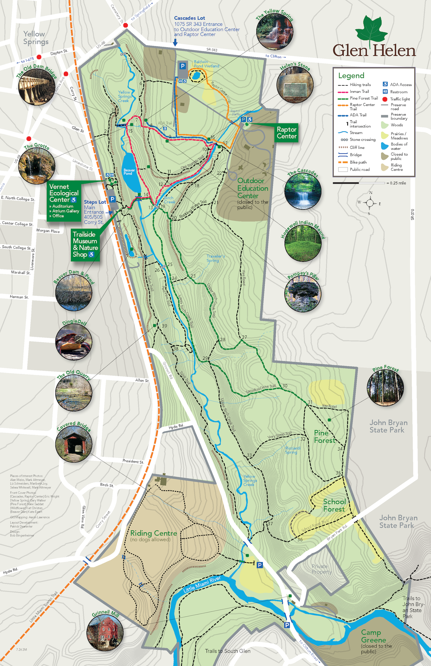
Glen Helen Trail Map
For the safety of our visitors during COVID-19, a one-way trail system is in effect on the Inman Loop trail in an effort to support social distancing efforts. We ask that all visitors come prepared with a face mask and wear it when unable to maintain a safe distance from other parties. Buildings, including restrooms, remain closed, so please plan accordingly.
Downloading a Trail Map! The trail map clearly outlines official trails within the nature preserve. Please be courteous and follow all trail rules when visiting the Nature Preserve; to view, please visit FAQ's to view trail rules.
When reading the map, notice the gray topographic contour lines, used to indicate elevation, small chartreuse prairies and meadows, blue lines indicating water, and brown areas outlining areas within the Glen that are closed to the public. The Riding Centre, a therapeutic equestrian facility, shown with light brown shading. Hiking is not permitted through the Riding Centre.
When planning your hike, take note of the contour lines: The closer the spacing, the more rapid the change in elevation. For a leisurely stroll, choose trails that cross a low number of contour lines. For a high-intensity hike, look for a concentration of contour lines in a single area. Due to our topography, all hikes at Glen Helen are considered moderate intensity.
Production of the trail map was sponsored by Jail House Suites and the Yellow Springs Brewery.